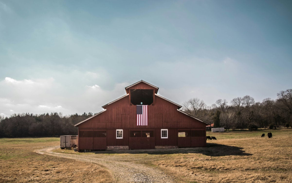
Northeast Missouri is not one uniform land market. A farm near Memphis may combine row-crop fields with wooded Fabius River tributaries. Ground outside Edina may be divided by rolling fields, timbered draws, and gravel roads. A property near Monroe City may attract buyers interested in farming, hunting, and access to the Mark Twain Lake region. Farther east, land near Canton, Palmyra, and Louisiana may require a closer look at Mississippi River bottoms, bluff ground, drainage, and flood access.
That variety is one of the region’s strengths. It is also why buyers should avoid judging a property by acreage and price alone.
The right Northeast Missouri property depends on:
- Where it is located
- How the land is divided
- Which soils are present
- How water moves across the property
- Whether the fields are leased
- What wildlife habitat exists
- Whether ponds and buildings are in usable condition
- How the property is accessed
- What it will cost to support your plans
This guide explains how those questions change throughout the Northeast Missouri region and what to investigate before making an offer.
Start With the Part of Northeast Missouri That Fits Your Plans
Communities provide convenient reference points, but rural land should be evaluated at the parcel level. Properties within the same county can differ significantly because of soil, elevation, drainage, river systems, road access, and previous management.
Here is what buyers should consider in several common Northeast Missouri search areas.
Memphis and Scotland County
Memphis is the home base of Boyer Land Company and a practical starting point for buyers searching northern Northeast Missouri.
Rural properties around Scotland County may include:
- Corn and soybean ground
- Hay fields
- Pasture
- Timbered draws
- Creek corridors
- Ponds
- Hunting cover
- Rural homesites
- Mixed-use farms
The Fabius River system influences portions of this area. Even when a tract is not immediately beside a named river, smaller tributaries and drainageways can shape fields, timber, access, and wildlife movement.
On a Scotland County property, examine how fields are divided by draws and creeks. Aerial photographs may make the open acreage appear continuous even when wet crossings or steep banks separate one field from another.
Ask:
- Can farm equipment reach every field?
- Are creek crossings stable?
- Do wooded draws reduce the amount of truly tillable acreage?
- Are field edges showing erosion?
- Does the timber provide huntable access or only narrow cover?
- Are ponds dependable during dry weather?
- Is the property reached by a maintained road?
A buyer interested in both farming and hunting should look closely at the relationship between crop fields, timber, brush, and access. A mixed farm can provide income and recreation, but only if agricultural traffic and hunting entry routes can coexist.
Edina and Knox County
Edina and the surrounding Knox County countryside can appeal to buyers looking for agricultural acreage combined with hunting and rural seclusion.
Properties may contain larger open fields, smaller fields divided by wooded drainageways, pasture, ponds, creek bottoms, and blocks of timber. Acreage that looks simple on a listing map may be more complicated once elevation and water movement are considered.
When evaluating Knox County land, determine:
- Which acres have actually been planted
- Whether fields drain naturally or require improvements
- How much open ground is suitable for row crops
- Whether non-tillable acres provide useful habitat
- Whether creek crossings remain passable after heavy rain
- How quickly gravel roads recover from wet weather
- Whether existing fencing follows the property boundary
- Whether hunting access disturbs bedding areas
If the farm is rented, request the lease and a map showing exactly which acres are included. Do not assume the tenant’s use is limited to the obvious crop fields. Access roads, storage areas, hay ground, or other acreage may also be part of an agreement.
Kirksville and Adair County
Kirksville can serve buyers who want rural acreage while remaining relatively close to shopping, medical care, employment, supplies, and other regional services.
Adair County properties may include:
- Tillable ground
- Pasture
- Hay production
- Timber
- Hunting tracts
- Rural homes
- Small farms
- Larger mixed-use acreage
Buyers near Kirksville should pay close attention to the difference between physical distance and actual driving time. A tract may be only several miles from town but require travel on multiple gravel roads.
If you plan to commute or live on the property full time, test:
- Morning and evening travel time
- Winter road conditions
- Cellphone reception
- Internet availability
- School transportation
- Emergency-service access
- The cost of maintaining a long private driveway
Properties closer to Kirksville may also have more nearby homes, road activity, and competing land uses. That does not necessarily make them less desirable, but it may affect privacy, hunting pressure, livestock plans, and future development.
Visit the property during a weekday as well as a weekend. Listen for road noise, dogs, farm equipment, shooting, or other activity that may not be obvious during one scheduled showing.
Macon and Macon County
Macon County can attract buyers interested in farming, pasture, hunting, homesites, and recreational acreage. The area’s highway access can also matter to owners who live elsewhere and plan to visit on weekends.
When comparing Macon-area properties, look at:
- Distance from US 63 or US 36
- The route from the highway to the property
- Field size and shape
- Soil and drainage
- Timber configuration
- Pond condition
- Hunting access
- Nearby agricultural operations
- Distance to equipment, feed, and building suppliers
Proximity to Macon or the Long Branch Lake area may be attractive, but buyers should distinguish between being near a recreational feature and having legal access to it. A listing should not be assumed to include lake access, hunting access, or recreational rights beyond the property boundary.
Mixed-use properties can be especially appealing in this area. A tract may combine rented crop ground with timber, ponds, trails, and a building site. The key is assigning a realistic purpose and value to each component instead of pricing every acre as though it were equally productive.
Monroe City and the Mark Twain Lake Region
Monroe City can be a useful search point for buyers interested in Northeast Missouri land near Mark Twain Lake and the Salt River basin.
Property in this area may appeal to:
- Hunters
- Anglers
- Weekend landowners
- Cabin buyers
- Farmers
- Buyers seeking a future retirement property
- Owners interested in short-term recreational use
Proximity to Mark Twain Lake does not make every property suitable for the same purpose. Verify:
- Actual driving distance to a public access point
- Whether boat storage is allowed
- Whether a cabin or additional structure can be built
- Availability of electric service and water
- Septic suitability
- Road maintenance
- Floodplain status
- Deed restrictions
- Existing recreational leases
- Seasonal traffic
The Salt River watershed includes a mixture of streams, rolling uplands, agricultural ground, and lower areas. A buyer should determine whether a property’s attractive creek bottom or low field also experiences access or flooding problems.
For hunting land, study how the property connects with surrounding crop ground and timber. A parcel’s value as wildlife habitat depends partly on what exists beyond its boundaries.
Palmyra and Marion County
The Palmyra area can provide access to rural acreage while remaining near US 61, Hannibal, and the Mississippi River corridor.
Marion County properties can vary considerably between upland farms and lower ground influenced by rivers and tributaries. Buyers should avoid treating county-wide averages as though they describe an individual tract.
For agricultural land, ask:
- Is the property upland or bottom ground?
- Is drainage natural, tiled, ditched, or dependent on other infrastructure?
- Has the field experienced prolonged standing water?
- Are there levees nearby?
- Is access maintained during high-water conditions?
- What crops have been grown recently?
- Are there yield records or only estimates?
- Is crop insurance history available from the operator?
For building acreage, investigate water movement before choosing a home location. A high point with a good view may still require an expensive driveway, utility extension, well, and septic system.
Buyers who want to live on the property should also consider traffic from US 61, nearby rail lines, industrial activity, or agricultural operations.
Canton and Lewis County
Canton and Lewis County offer a mixture of agricultural land, Fabius River country, Mississippi River influence, wooded slopes, creek corridors, and rural homesites.
The North and Middle Fabius Rivers meet in southeastern Lewis County before continuing toward the Mississippi River. That system can influence drainage, field patterns, bottomland, timber, and wildlife movement.
On Lewis County property, compare:
- Upland and bottomland acreage
- Field access during wet seasons
- Creek and river crossings
- Bluff or slope conditions
- Timber quality
- Flood history
- Erosion
- Road elevation
- The location of utilities relative to a building site
Low ground may offer productive soils, wildlife habitat, or recreational appeal, but it can also carry greater flood, drainage, and access risk. Upland ground may provide more dependable access but contain slopes that affect cropping or construction.
If a property includes river or creek frontage, confirm the actual boundary. Water movement can change banks, and the visible waterline may not match the legal description.
Louisiana and Pike County
Louisiana sits along the Mississippi River in Pike County. Rural properties in the surrounding area may include river-bottom agriculture, upland farms, wooded bluff ground, hunting acreage, homesites, and recreational land.
The transition from bottomland to bluff and upland terrain can create dramatic differences within relatively short distances.
For low-lying property, research:
- FEMA flood mapping
- Local flood history
- Levee protection
- Road closures
- Crop-loss history
- Drainage infrastructure
- Emergency access
- Insurance requirements
- Building limitations
For bluff and upland property, evaluate:
- Slope
- Erosion
- Driveway construction
- Timber access
- Septic suitability
- Well depth
- Utility-extension costs
- Whether steep ground reduces usable acreage
A scenic Mississippi River view can be valuable to a buyer, but it should not distract from access, construction cost, restrictions, and long-term maintenance.
Do Not Value Every Acre the Same Way
One of the most common mistakes in buying rural land is dividing the asking price by the total acreage and treating that result as a complete comparison.
Imagine two 80-acre properties.
The first contains:
- 62 acres of accessible tillable ground
- 10 acres of timber
- A pond
- Road frontage
- An existing farm lease
- Electricity at the road
The second contains:
- 25 acres of irregular open ground
- 45 acres of timber
- 10 acres of draws, creek, roads, and pond
- Limited interior access
- No current lease
- A secluded cabin site
These properties serve different buyers. The first may appeal more strongly to someone seeking farm income. The second may appeal to a hunter or recreational buyer.
Create an acreage budget for each property:
| Land Component | Approximate Acres | Intended Use | Immediate Work Needed |
|---|---|---|---|
| Tillable ground | Farming or lease income | ||
| Pasture or hay | Livestock or hay | ||
| Timber | Hunting, recreation or forestry | ||
| Water and drainage | Fishing, livestock or wildlife | ||
| Building area | Home, cabin or shop | ||
| Roads and unusable acreage | Access or buffer |
This exercise forces you to identify what you are actually buying.
Examine the Soil at Field Level
The USDA Web Soil Survey is useful for early research, but do not stop after looking at a colored soil map.
For each important field or building area, review:
- Soil-series name
- Slope
- Drainage class
- Farmland classification
- Erosion risk
- Hydric-soil indicators
- Limitations for roads
- Limitations for septic systems
- Available water capacity
- Depth to restrictive layers
Then compare the mapped information with field conditions.
Look for:
- Eroded hillsides
- Gullies below crop fields
- Wet spots
- Drainage ditches
- Failed terraces
- Sediment deposits
- Thin crops
- Compacted entrances
- Exposed clay or subsoil
- Areas that have been removed from production
A farm may be advertised with a single average soil rating, but field performance often varies. Ask for yield history, fertilizer records, lime applications, drainage improvements, and conservation practices.
Do not apply the productivity of the best field to every tillable acre.
Verify the Acres Being Farmed
Listing descriptions often use terms such as “approximately 50 tillable acres.” Determine what that means.
Ask for:
- Farm Service Agency maps
- Planted-acre records
- Current field boundaries
- Crop history
- Conservation-program contracts
- Yield information
- Soil-test results
- Fertilizer and lime history
- Drainage records
- The current farm lease
Compare those records with aerial maps and what you see onsite.
Tree lines may have expanded into old fields. Wet corners may no longer be planted. A tenant may farm around erosion or access problems. Field borders shown on an old map may no longer reflect current use.
Also determine whether hay ground is being counted as tillable acreage. Hay production, pasture, and row-crop ground should not automatically be evaluated as though they provide the same return.
Understand the Farm Lease Before You Buy
Missouri farm leases may be written or verbal. A sale does not necessarily erase the tenant’s rights.
Before making an offer, determine:
- Who the tenant is
- Whether the agreement is written or verbal
- Which acres are included
- The lease start and termination dates
- Whether rent is cash, flexible cash, or crop share
- When rent is paid
- Who owns the growing crop
- Who pays for lime, fertilizer, seed, and repairs
- Who maintains roads, fences, terraces, and drainage
- Whether hunting rights are reserved
- Whether the lease renews automatically
- What happens when the property is sold
Request written confirmation rather than relying on a summary in the listing.
If you intend to farm the property yourself, the possession date matters. If you intend to retain the tenant, evaluate the lease history and whether the current arrangement reflects the property’s condition and productivity.
Inspect Pasture as a Forage System
Green grass does not automatically mean productive pasture.
Walk the pasture and identify:
- Dominant forage
- Weeds
- Brush encroachment
- Bare soil
- Erosion
- Wet areas
- Shade
- Water sources
- Fence condition
- Gate placement
- Opportunities for rotational grazing
Ask how the pasture has been used and when it was last fertilized, limed, renovated, or rested.
For livestock, evaluate whether water reaches every planned paddock. A pond located at one end of a property may not serve a rotational-grazing system without additional tanks or water lines.
Inspect barns, corrals, loading areas, hay storage, and electrical service. Price the property based on the current condition of these improvements, not merely their presence.
Read Hunting Habitat as Part of a Larger Landscape
Northeast Missouri hunting properties are often shaped by the relationship between agriculture and cover.
Missouri Department of Conservation guidance emphasizes habitat diversity. Crop fields, timber, old fields, brush, woodland edges, and dense cover can collectively provide food, bedding, escape cover, and travel corridors.
When studying a hunting property, map:
- Crop fields
- Timber blocks
- Brush
- Old pasture
- Creek corridors
- Ponds
- Bedding cover
- Likely travel routes
- Road access
- Neighboring homes
- Adjacent hunting pressure
- Stand entry routes
Look beyond trail-camera photographs. Ask when and where the photograph was taken. A deer photographed at night during the rut does not prove that the property consistently holds deer during daylight.
Determine whether the property contains:
- Secure bedding cover
- Food near cover
- Multiple habitat types
- Interior areas away from roads
- Huntable routes for different winds
- Locations that can be reached without crossing feeding areas
- Space for habitat improvements
- Access for equipment
Also check current Missouri Department of Conservation regulations for the county, including any chronic wasting disease rules that could affect feeding, mineral use, carcass movement, or testing.
Evaluate Turkey and Small-Game Habitat Separately
A property marketed for deer hunting is not automatically strong turkey or small-game habitat.
Turkey habitat benefits from a combination of:
- Mature trees for roosting
- Open areas for feeding
- Insect-rich brood habitat
- Low vegetation
- Secure nesting cover
- Travel routes between habitat types
For quail and rabbits, look for brushy edges, native grasses, weedy areas, shrubs, and escape cover. A clean farm with field edges mowed tightly to mature timber may offer less small-game habitat than a property with wider, diverse transition zones.
Ask whether the owner has sprayed, burned, mowed, grazed, logged, or managed the field borders. Management history can explain why a property contains strong cover or very little of it.
Inspect Ponds Like Structures, Not Scenery
A pond is both a water feature and an engineered system.
Walk the entire pond and inspect:
- The upstream and downstream faces of the dam
- The emergency spillway
- Pipes and principal spillway
- Shoreline erosion
- Trees growing on the dam
- Animal burrows
- Wet areas below the dam
- Sediment buildup
- Livestock access
- Aquatic vegetation
- Algae
- Water level
- The surrounding watershed
Ask:
- When was the pond built?
- Has the dam been repaired?
- Does the pond hold water during drought?
- Which fish species are present?
- Are anglers catching balanced sizes of fish?
- Has the pond experienced a fish kill?
- Is the pond used for livestock?
- Does field runoff enter the pond?
- Who maintains the dam and spillway?
A pond with water is not automatically a healthy fishery. If fishing is a major reason for buying, consider a professional evaluation.
Treat Creeks and Rivers as Both Assets and Constraints
The Fabius, North, Salt, and Mississippi River systems contribute to Northeast Missouri’s farming, scenery, fishing, and wildlife habitat. They can also create erosion, flooding, crossing, and access problems.
For creek or river property, investigate:
- Whether the water is seasonal or permanent
- Bank erosion
- Debris accumulation
- Flood evidence
- Crossing condition
- Culvert capacity
- Whether water divides the farm
- Whether every field remains accessible
- The location of the legal boundary
- Public-access questions
- Floodplain mapping
- Road elevations
Visit after rain if possible. A shallow crossing during dry weather may become impassable when you most need to reach livestock, crops, or a hunting area.
Verify the Building Site Before Valuing It as Buildable
A listing may describe a “great building site,” but buyers should verify that statement independently.
Before assigning value to a future homesite, confirm:
- Legal access
- Driveway approval
- Road-maintenance responsibility
- Electric availability
- Cost to extend power
- Rural water availability
- Well feasibility
- Septic suitability
- Internet options
- Cellphone reception
- Floodplain status
- Zoning
- Deed restrictions
- Minimum building requirements
- Emergency access
- Site-preparation costs
A ridge may provide a beautiful view but require extensive excavation and a long utility run. A level field may be cheaper to build on but remove productive acreage from farming.
Obtain actual estimates whenever utilities or access could materially affect your budget.
Price the Work That Begins After Closing
A rural property can require immediate spending even when the land itself appears affordable.
Create a first-year improvement budget for:
- Surveying
- Title work
- Fence repair
- New gates
- Gravel
- Culverts
- Creek crossings
- Brush removal
- Invasive-species control
- Pond repairs
- Dam maintenance
- Pasture renovation
- Soil testing
- Lime and fertilizer
- Trail construction
- Building repairs
- Well and septic work
- Utility installation
- Equipment
- Insurance
Then separate these costs into:
- Required before the property can be used
- Needed within the first year
- Long-term improvements
- Optional projects
A cheaper property with major infrastructure needs may ultimately cost more than a higher-priced tract that already supports your intended use.
Documents to Request Before Making an Offer
For a Northeast Missouri rural property, request as many of the following as are applicable:
- Legal description
- Recent survey
- Title information
- Recorded easements
- Farm Service Agency maps
- Planted-acre records
- Current farm lease
- Conservation-program contracts
- Soil maps
- Yield history
- Fertility and lime records
- Property-tax records
- Floodplain information
- Well records
- Septic information
- Utility information
- Pond construction or repair records
- Timber-management records
- Hunting leases
- Building permits
- Deed restrictions
- Road-maintenance agreements
Missing documents do not automatically make a property unsuitable. They do mean the buyer may need additional time and professional assistance during due diligence.
A Northeast Missouri Property-Tour Checklist
Bring this checklist when walking the land:
Access
- Is the access legal and recorded?
- Who maintains the road?
- Can a truck, trailer, tractor, or emergency vehicle reach the property?
- Does access cross a creek or low area?
- Can the entire property be reached during wet weather?
Farming
- Which acres are currently planted?
- Are the field entrances wide enough for modern equipment?
- Are terraces, waterways, and drainage structures maintained?
- Is there visible erosion?
- Are any fields separated by difficult crossings?
- Is a tenant currently farming the property?
Pasture and livestock
- What forage is growing?
- Where will animals receive water?
- Is the fencing suitable for the intended livestock?
- Are barns and handling areas usable?
- Can the pasture be divided for rotation?
Hunting
- Where are food, bedding cover, and travel corridors?
- How do neighboring properties affect wildlife movement?
- Can stands be reached without crossing feeding or bedding areas?
- Are there multiple access routes for different winds?
- Is hunting currently leased?
Water
- Does the pond hold water year-round?
- Is the dam stable?
- Are spillways functioning?
- Is the creek permanent or seasonal?
- Does water prevent access to part of the property?
- Is there evidence of flooding or bank erosion?
Building
- Where are the nearest utilities?
- Has a septic site been evaluated?
- How long will the driveway be?
- Is the site outside the floodplain?
- Are there restrictions?
- What will site preparation cost?
Find Land Based on Purpose, Not Just Acreage
The best rural land in Northeast Missouri is not necessarily the tract with the most acres or the lowest price per acre.
A productive farm buyer may prioritize contiguous fields, soil, drainage, lease terms, and grain-market access. A hunting buyer may value timber configuration, bedding cover, entry routes, neighboring habitat, and seclusion. A homesite buyer may focus on utilities, legal access, septic suitability, road conditions, and proximity to services.
Many buyers want a combination of these features.
Boyer Land Company is based in Memphis, Missouri, and helps buyers compare rural properties throughout Northeast Missouri. If you are searching near Memphis, Edina, Kirksville, Macon, Palmyra, Monroe City, Canton, Louisiana, or the surrounding countryside, begin by explaining what you need the land to accomplish.
Share your intended uses, preferred area, acreage, budget, and must-have features. That information can narrow the search to properties that fit your plans and eliminate land that only looks appealing on paper.
Browse available Boyer Land Company properties or tell us what you are looking for.